Rutgers Scientists Aim to Create Best Image Ever of Ramapo Fault Zone
New data gathered will aid predicting hazard levels and locations of future earthquakes
A Rutgers University–New Brunswick-led team of geologists has launched a comprehensive effort to analyze and record the seismicity of the area near the epicenter of the April 5 earthquake near Tewksbury Township, N.J.
When completed, the project is expected to yield the clearest measurements yet of the geometries of the subterranean geological conditions of portions of the Ramapo Fault Zone, a 20-mile-wide area lying adjacent to and west of the Ramapo Fault. Most New Jersey earthquakes have occurred in this fault area.
Creating this highly detailed map of seismicity will help scientists better understand the hazards associated with the zone and enable them to more accurately predict where future earthquakes are likely to occur, said James Bourke, a postdoctoral associate in the Department of Earth and Planetary Sciences in the School of Arts and Sciences.
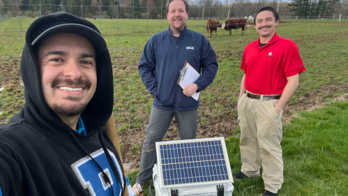
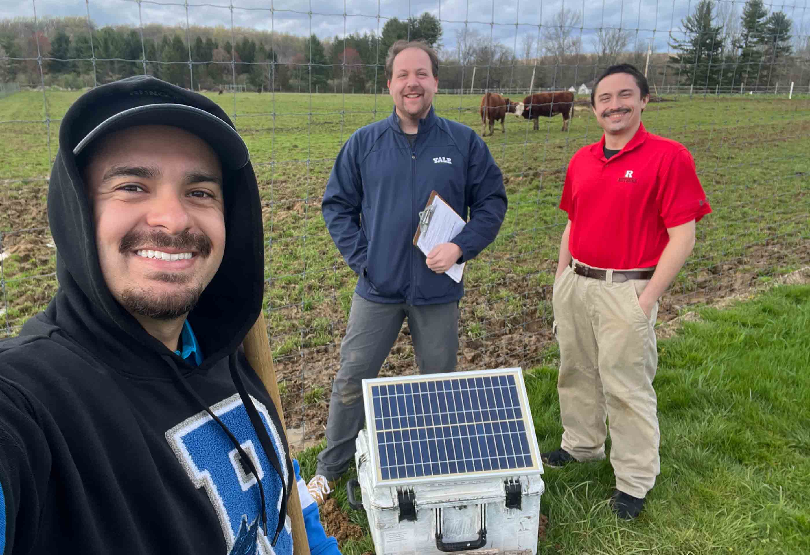
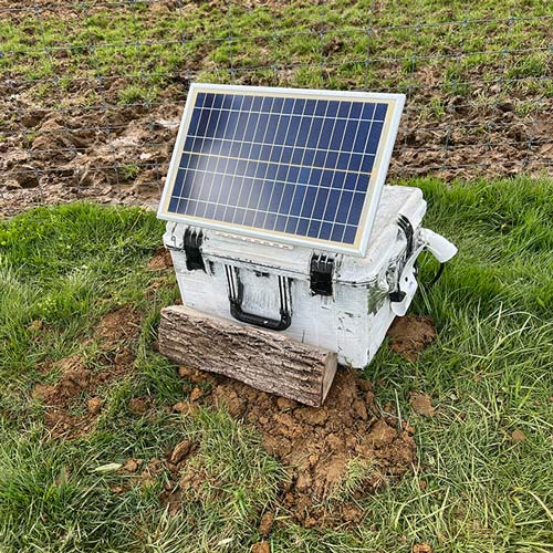
Central to the project are 110 advanced seismometers – sensors that capture the severity, distribution and frequency of shaking and ground noises – that, now installed, are actively recording data at carefully chosen spots mainly in Hunterdon County, but also in Middlesex, Morris and Somerset Counties. The seismometers will gather data for varying periods, from as short as a month to several years, depending on the installation. In a second phase of the project, the research team is planning to install up to 500 more devices at areas along the broader Ramapo Fault region.

“We’ll be studying the earthquake and its aftershocks,” said Bourke, a seismologist who has led the installations. “But we can also align the instrument array to ask other science questions at the same time.”
Faults are fractures within bedrock, usually miles deep. Earthquakes mainly occur when accumulated strain in the Earth’s crust is suddenly released and creates a fault or leads to movement along an existing fault. The energy that is set free travels as seismic waves both along the Earth’s surface and below it. With a magnitude of 4.8, the earthquake centered near Tewksbury was felt by more than 42 million people along the East Coast, according to the U.S. Geological Survey.
Close to 200 aftershocks have occurred in the earthquake’s aftermath. Seismic activity in the area is likely to continue for months.
“The rock in that area is acting a bit like Jell-O,” said Kenneth Miller, a geologist and distinguished professor in the Department of Earth and Planetary Sciences. “After the first big shock, it shook a lot. And now it will shake just a little bit for a long time.”
It isn’t easy for scientists to find recently active faults east of the Rocky Mountains because, unlike what is seen with West Coast earthquakes, East Coast earthquakes that break the surface don’t happen very often, said Lauren Neitzke Adamo, a geologist and associate professor in the Department of Earth and Planetary Sciences. East Coast fault line locations have long been determined through the interpretation of seismological records, meaning that scientists have relied on earthquakes to point them to faults.
“On the East Coast, if there is any evidence of an earthquake, it’s likely to have been eroded away,” Adamo said. “So, the only chance of us really figuring out where these faults go is by looking at the data coming from a project like this one.”
Researchers know the urban corridor stretching from Boston to Virginia is littered with underground faults. Many smaller faults, however, remain undetected. The inaccessibility of the geological structures poses a challenge to seismologists seeking to determine if a known fault is still active and could cause an earthquake.
The installed seismometers won’t only collect data about aftershocks. In a process similar to sonar, they also will capture images of the contours of underground rock formations to pinpoint where the faults are.
The devices are powered by a boat battery connected to an above-ground solar cell and a computer that records the ground motion. The instruments are buried in holes that are about 2 feet deep. The collected information is sent to the U.S. Geological Survey’s National Earthquake Information Center in Colorado, where it will be analyzed.
The first results from the data-gathering effort are being put together by the U.S. Geological Survey for a research paper that will be submitted to a peer-reviewed science journal, Bourke said. “More in-depth analysis will take place over the next year or so for better understanding of the structures beneath the stations,” Bourke said.
To install the devices, Bourke received permission from officials managing the properties, including those in Hunterdon County at the Raritan Headwaters Association and the Tewksbury Land Trust.
Many of the prime installation sites were covered with thick foliage and Bourke, teamed with fellow seismologist Frederik Link of Yale University, were aided by Rutgers students clearing brush and digging holes. The equipment is on loan from a research consortium supported by the National Science Foundation and the U.S. Geological Survey.
“We’re really excited to be doing this work,” Bourke said. “This is an adventure, for sure.”

